


MODEL EVENTS
The control points will be materialized on the ground by an orange tape, identified by the number of the control point.
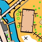
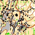
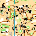
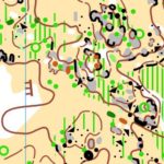
Model Events Sprint
Mapmaker of 2 maps of sprint: Rui Antunes
Scales: 1:4.000 |Contours: 5 mts
Penamacor Map
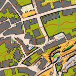
2016 production and update in January 2018
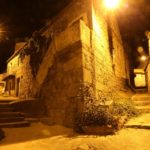
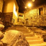
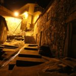
Urban area, mostly paved in parallel, with considerable unevenness, alternating the historic area of irregular street layout with more recent and more regular areas. Considerable climb.
Parking: At the Santo António terrace next to the Penamacor Municipal Chamber Building. Coordinates: 40.167989 -7.172010
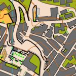
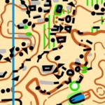
Map of Meimoa
Production in 2018 updated August 2019
Mixed terrain with open rural area and urban area paved in parallel with some unevenness, narrow streets and stairs.
Parking: Coordinates 40.226022, -7.188425 (Surrounding river beach of Meimoa)
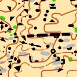
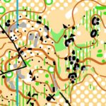
Model Events Forest
Rachã & Dongalinho Map
Rachã
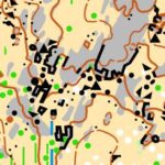
Production in 2015 and updated last quarter of 2017
Dongalinho with a new area of 2.6 Km2 mapped in 2017
Mapmaker: Rui Antunes
Scales 1: 7.500, 1: 10.000 and 1: 15.000 | Contours: 5 mts
Parking: It will take place within the map area. Coordinates 40.090810, -7.207569, which will also appear on the map.
Control points: Control points will be placed on the ground in 2 different areas of the map, which replicate the area of competition.
Anascer Map
Production in 2015 and update in 2020 by Rui Antunes
Mapmaler: Rui Antunes & José Batista
Map scale: 1: 7.500 and 1:10 000 |Contours: 5m
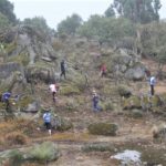
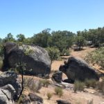
Bas-relief terrain, reduced undergrowth, mostly open (without trees) and with a lot of rocky details.
Parking: 40.273318, -7.247537
Serrinha & Aldeia do Bispo
Production in 2015 and update in 2020
Mapmaker: Rui Antunes
Scales 1: 7.500, 1: 10.000 and 1: 15.000 | Controus: 5 mts
Land with considerable unevenness, rich in rocky details, alternating areas of good progression with others of lesser speed of progression, sometimes due to the unevenness, sometimes due to vegetation. It provides good technical challenges mainly in the choice of options, which is important in a Long Distance.
Parking will be indicated in the near future, but GPS coordinates will be printing on maps.
Memória
Production in 2015 and update in 2020 by Rui Antunes
Mapmaker: Rui Antunes
Scale: 1: 7.500 and 1:10 000 |Contours: 5 mts
Bas-relief terrain, reduced undergrowth, with rocky details.
Parking 40.133041, -7.207646
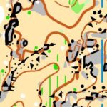
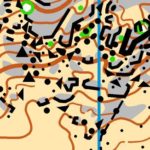
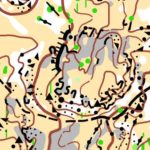
COMPETITION – MIDDLE DISTANCE – WRE (stage 1)
Map: Carvalhal
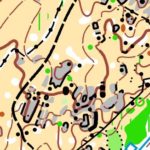
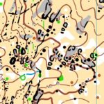
Ground: Open and semi-open areas with rocky elements and details of relief. Good progression and visibility.
Mapmaker: Rui Antunes
Scales: 1: 7.500 | 1: 10.000 | Contours: 5 meters
Course planners: Carlos Monteiro / Rui Antunes
Parking (for both middle distances): Cars, motorhomes and buses: 40.100591, -7.152407
Starts: To be released in due time
Arena layout: To be released in due time
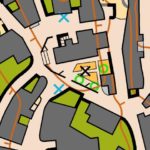
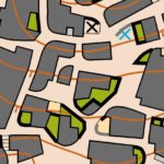
COMPETITION – SPRINT NIGHT RUN (stage 2)
Map: Pedrógão de São Pedro – 2020
Mapmaker: Rui Antunes
Scale: 1: 4.000 |Contours: 2,5 meters
Course planners: Tomás Lima / Rafael Lima
Parking: Rua Tenente Manuel Morais (area surrounding the Football Field) Coordinates 40.091101, -7.238152
Arena layout: To be released in due time
COMPETITION – MIDDLE DISTANCE (stage 3)
Map: Carvalhal
Ground: Land with varied vegetation between cork and oak trees, alternating with open and semi-open areas, with some relief and rocky elements. In general, it provides good progression, alternating zones with greater or lesser visibility.
Mapmakers: Rui Antunes
Scales: 1: 7,500 | 1: 10,000 | Contours: 5 meters
Course planners: Carlos Monteiro / Rui Antunes
Parking (for both middle distances): cars, motorhomes and buses: 40.100591, -7.152407
Starts: To be released in due time
Arena layout: To be released in due time